Pekalongan city has an infrastructure that is adequate to support the existing investment climate, so that not only attracts investors, but also offers a comfortable shelter for the community.
Transportation means in Pekalongan city include :
1. Bus Station
Bus station in Pekalongan is included in the category of Type A which functions to serve the flow of long-distance passenger transport (regional) between City and Province. Buses for Inter- City in the Province are available up to 82 units.

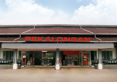
2. Railway Station
Pekalongan railway station is placed on Gajah Mada Pekalongan Street. The station is located in the strategic place because it is precisely in the northern coast road. The station for class 1 is in the operational Regional 4 Semarang and it has a LocomotiveSub depot and Logistics Warehouse.
3. Road
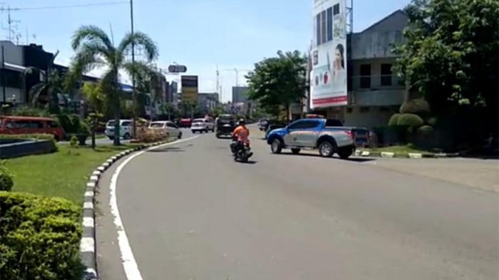
Road is a vital means of supporting transportation which has an important role, especially for road transport. The length of roads in Pekalongan City in 2015 reached 155.44 km consisting of 10.73 km along the country roads, 4.22 km along the provincial roads and 140.49 km along the city streets. 10.73 km along the country road has been asphalted in good condition which is the class I. Road provincial Street along 4.22 km is a class I road with the kind of paved roads, in good condition. The City Road length 140.49 km has been asphalted as long as 130.3 km (92.74%) and the good road conditions throughout 100.52 km (71.55%)
4. Highway
Pekalongan City government, immediately release the land owned by citizens of Pekalongan City about 30,000 square meters to access "interchange" Pemalang-Batang toll road Worth 9 billions rupiahs. The interchange is intended that the exit access of toll road leading to Pekalongan City can be realized. It is intended for the construction of the highway will not give bad impact for the economy in Pekalongan City. The construction of Pemalang-Batang toll road is planned to begin in 2017. This Exit Toll is planned through Ir. Sutami Street connected directly to the northern coast road and passes through three villages, that are Soko Duwet and Kuripan Yosorejo , South District of Pekalongan City, and Kali Baros, East District of Pekalongan City.

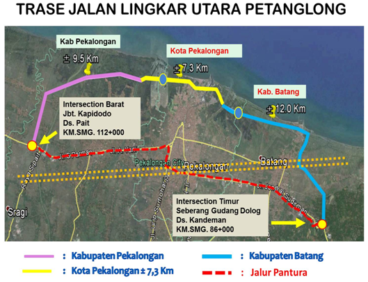
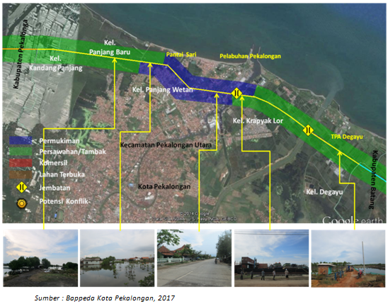
5. Northern Ring Road Plan (Jalingkut Petanglong)
Pekalongan City Government has proposed Jalingkut Petanglong Project to the Ministry of Public Works and Public Housing. The project has been included in the strategic plan of the central government until 2019. The Jalingkut Petanglong project is planned to be extended from Pekalongan regency to Batang regency approximately 26 kilometers. For Pekalongan city, it will stretch as far as 6-7 kilometers. Land area of Pekalongan city that will be affected by Jalingkut project is estimated at about 29.2 hectares. It is estimated that there will be seven villages in the City of Batik that will be passed Jalingkut. Those villages are Bandengan, Kandang Panjang, Panjang Baru, Panjang Wetan, Krapyak, Degayu, and Padukuhan Kraton (former Village of Pabean).